• Home
  • Painting/Drawing
  • Graphic Design
  • Installations
  • Shop
  • Poems
  • Adventure Blog
  • CV/Contact
Menu

Zane White

Multimedia Creations
  • Home
  • Painting/Drawing
  • Graphic Design
  • Installations
  • Shop
  • Poems
  • Adventure Blog
  • CV/Contact
Jackson's Hubris 2017 Mixed Media Oil on panel

Jackson's Hubris 2017 Mixed Media Oil on panel

Oil Birds

December 13, 2017

The Painting Jackson's Hubris was made in 2017 as a demo for my high school advanced art class for a mixed media project I had them do. Since I was already experimenting with incorporating collage elements into my paintings, I decided to see the demo through to a final painting as well.  A student of mine was already doing work with college and decided to use money as part of her work. This reminded me of the feeling my early punk rock collage art and political cartoons gave me. Teaching students at a high school level brought back a lot of nostalgic memories of doing art for a laugh, or to shock my parents or teachers, or just for the hell of it. This was ultimately a reflection on where I was with my art currently, and the sort of adolescent angst satisfaction from doing something shocking was extremely attractive to me at that point. I felt like a little deviant again as I used student lab fee money and copied it on the school copier. Since I have heard it is technically illegal many times in my life, it only made the moment all the more satisfying. It also conjures up connections with Jasper Johns Flags, which were part of the curriculum I was teaching in this unit. I had already been having fun using collage, but this project opened up a little deviancy that had been missing in my practice and ultimately loosened me up to make what I feel is a very profound work. The bright yellow hair and orange skin on Andrew Jackson is intentionally the result of creating the work shortly after/ during the election of Donald Trump, and the use of the imagery was meant to directly confront the ugly history of Jackson's legacy while also showing some of the contemporary results of manifest destiny with the inclusion of iconic oil well silhouettes. The fact that I can simultaneously pseudo counterfeiting currency, visually attack the legacy Andrew Jackson and American money, and create an image of an animal that intentionally creates an emotional reaction is really too much to leave it at one work, so I decided to make many because I liked it so much. Right now I like the 12 x 12 format because it makes the works intimate and allows for the money to be real life size.

Work in progress... Pelican

Work in progress... Pelican

The research I did into the story of the American Bison was tragic, and the image of the dead bison lying in oil was an unforeseen consequence of making the idea of the painting work. Consequently, it lead me to look at contemporary animals that were actually covered in oil. It reminded me of when the Deep Water Oil Horizon Spill happened in the gulf coast, and I remember seeing it on the news being horrified. When they showed pictures of the birds covered in oil it actually made me cry. It is interesting how this idea came full circle. The current renditions of this idea are all birds impacted by oil and gas development, and naturally, i have had to revisit some of those images. I hope to bring the viewer to some sense of compassion for the animal in these works, maybe enough to bring a tear, and then have it tied to exactly what is driving these tragedies to happen. the influence of big money oil and gas industries on our politics and society.  

Work in progress...

Work in progress...

Middle Fork of the Gila River near Swinging Cross Canyon. Photo By Zane White

Middle Fork of the Gila River near Swinging Cross Canyon. Photo By Zane White

The Gila Wilderness

December 10, 2017
“Wilderness is not a luxury but a necessity of the human spirit, and as vital to our lives as water and good bread. A civilization which destroys what little remains of the wild, the spare, the original, is cutting itself off from its origins and betraying the principle of civilization itself. ”
— Edward Abbey. "Desert Solitaire"

"Our Water" is an oil painting created in response to a proposed dam of the Gila River in New Mexico, the last continuous wild watershed in the United States. The Gila Wilderness is an invaluable cultural resource, and a wilderness sanctuary for many residents of New Mexico, both human and animal. The painting features a Coatimundi, and animal native to the area, and was painted on top of a Gila Wilderness Map used in a backpacking journey in 2015. The Tibetan Prayer flags, untethered and blowing in the wind, represent the ominous and foreboding feeling of a world made of concrete and steel. The Coatimundi, adorned with a halo containing a Mimbres pottery design, dances like Shiva, the Hindu deity, on one leg in the midst of change.

The Gila Wilderness was designated the world's first wilderness area on June 3, 1924, Along with Aldo Leopold and Blue Range Wilderness, the 558,014 acres (225,820 ha) (872 sq. mi.) wilderness is part of New Mexico's Gila National Forest. - wiki intro.

To me, the Gila is a sanctuary I have visited many times throughout my life. I have childhood memories of the Gila, fishing with my Dad and Brother on hot New Mexico days at Lake Roberts, and driving off road in the mountains without another human in sight for miles and miles and miles.  As an adult, I have been on two long backpacking trips there over the past couple years. There are many reasons to visit the Gila. The place is spectacularly gorgeous and easily compares to the canyons of Utah, the meadows and cliffs of Yosemite, and the Rocky Mountain High in the late summer. However, the reason for my visit in April of 2015 was partly due to an urgency to see it in all its glory one last time before it was dammed up and damaged forever! The trip brought on feelings reminiscent of Edward Abbey's masterpiece, "Down the River." I was going with 3 of my buddies who were all from Las Cruces, and a bit older. So the spirit of the trip was that of a true coming home to say goodbye one last time.

In the news, there was an unfortunate common story of a poor mining town, Silver City, NM in this case, that wanted to sell off a national treasure for the prospect of temporary jobs and a promised allocation of money from an outside source. In this case, it was an increased demand for water coming out of Arizona, because, In the end, the Colorado River was not enough I suppose. The proposition was a dam on the last continuous wild watershed in the continental United States, and in the first designated wilderness in United States History. The water would go to Arizona. The profits to a private company and the biological diversity of a historic monument and wildlife sanctuary would be heavily impacted. The only benefit would be a fund set up for New Mexico to construct the dam, which would be completely used in the construction. So the net "profit" of the construction would be short term employment opportunities for Silver City residents, and some ease of access to water for farmers. For such a small gain, it seems completely ridiculous to even dream up the project. Yet, at the time of this trip, the area was already being surveyed.

Draft-Final-Diversion-and-Storage-PER-91-1.jpg

Fortunately, because of massive public opposition and mobilization, this project has been halted, even under a Republican Governor. The details of the project are thankfully moot for the time being, because of the extremely low likelihood of the project moving forward in legislation, however, it still serves as a reminder of why it is important to protect the remaining wild areas of our world. More info on this project can be found at the Gila Conservation Website.

During that 2015 backpacking trip, we spotted a group of Cotamundi at night climbing on the canyon walls. We could see their eyes reflecting the light from our fire on the opposite side of the river. I had never seen that creature before. We couldn't see them very well in the darkness, however, a friend of mine who had been there many times had spotted them before and told us it what the mysterious creature was.

Coati18.jpg

During the course of our 50 + mile trek up the middle fork of the Gila River, we were rewarded with hot springs, clear nights filled with stars, lush canyon vegetation, swimming holes, and sculpted cliff walls that would rival any place in the world. Five days in, the trip took an ominous turn following foreboding surreal signs of blairwitch style tarp dwellings that were abandoned and trashed. We climbed up the canyon too soon and ended up chasing an elk trail until it hit a dead end. Tired and impatient we decided to scout the upper canyon edge and became separated from one another!!! All wilderness horror stories flooded my head immediately once I realized what had transpired. What followed resulted in our group of 4, 5 if you count my dog, Dali, getting split into two groups for the rest of our stay. My party took a wrong turn and went up Iron creek until the rocks became so slippery that we were forced to ascend the canyon going straight up, following elk trails again. I should clarify that in a canyon river system it is very easy to lose your sense of direction. Each canyon wall looks the same, and because of the constant river crossings and bends, mixed with the inability to see where the sun is at most points of the day, the natural tools of guidance are limited. Combine that with fatigue and fading light, and you wake up in the morning thinking your heading up the Middle Fork of the Gila when you took a wrong turn up a smaller, and much steeper, tributary creek.

After ascending the canyon we followed elk tracks, trying to pinpoint our location and figure out where we were. Guesses lead to more guesses and we found ourselves in the middle of nowhere at a very small spring found out of pure happenstance. Dehydrated and hoping we were close to a trail we decided to scout until we realized it best to fill up our water. An iconic image in most settings in New Mexico, a bull skull, now transformed into the most surreal and ominous signs, sat nailed to a tree next to the very shallow spring. As we continued to ascent we were sure to find the trail we were looking for at the top of the ridge, but when we got there, we only saw another never ending expanse of mountains for miles, with no trail in sight. As an experienced trail man, there have been many moments of where I have experienced Kant's Sublime. The feeling of supreme beauty and terror while looking at the vastness of distance in the western wilderness is a common occurrence. Being a few days walk from your car or any other human being will definitely humble you to the power relationships of the wild. However, at that moment when we were looking at that ever-expanding distance of range upon range, something that would be a great feature on a postcard, I truly knew what it felt to be utterly terrified by it. The logical probability becomes less that one will be discovered, or find their way back, looking over a distance like that with nothing but blue sky and open land. The stillness in the air is palatable, and the only creatures to look to for guidance are the elk up in the distance.

The only choice is to go down the other side of the ridge we came up, hoping that we can at least find our way back down to the water. Fortunately, as we get down to the bottom we stumble upon a trail. That trail leads us to a parking area 5 or so miles later that is 15 miles from our intended destination. All we can do is wait and thank the universe we might be able to hustle a ride back to my truck from someone. Still unsure about our two other friends, our plan is to head back down the trails once we establish ourselves back at my truck. About 15 minutes after we had reached the parking area, our two companions who found the right way come driving up in the truck and come to the rescue. Like out of a fairy tale. Surreal.

The painting "Our Water" is painted on top of the map I used during this trip. This brings on personal connotations of getting lost, obviously, that relate to the idea of hubris and the mistake of getting lost in looking only at monetary benefits. Additionally, I adorned the coatimundi with a halo incorporating a Mimbres Pottery design to honor the ancient peoples of this land who also had a long and advanced tradition of art making 700 years before the Spanish arrived.

our water.jpg

Below you will find some of the best photographs I have taken in this sanctuary and national treasure. From the images, I hope you can get a sense of the value this real life garden of Eden in the middle of the desert mountains of southern New Mexico has to the rest of the world. At the moment I am typing this, Donald Trump and an army of oil and gas developers are attempting to shrink Bears Ears National Monument in Utah. It is important for us to stand up and fight every attempt at environmental encroachment, especially at a time of climate catastrophe from decades of environmental misuse. Because otherwise, we may be telling the same story Edward Abbey tells in "Down The River" about how our Garden of Eden was flooded for commercial enterprise.


DSC_4004.jpg
DSC_4006.jpg
DSC_4020.jpg
DSC_4011.jpg
DSC_4369.jpg
DSC_4375.jpg
DSC_4391.jpg
DSC_4022.jpg
DSC_4405.jpg
DSC_4006.jpg
DSC_4011.jpg
DSC_4004.jpg DSC_4006.jpg DSC_4020.jpg DSC_4011.jpg DSC_4369.jpg DSC_4375.jpg DSC_4391.jpg DSC_4022.jpg DSC_4405.jpg DSC_4006.jpg DSC_4011.jpg
Homestake Mine. Photo By Zane White

Homestake Mine. Photo By Zane White

Ambrosia Lake and Mt. Taylor

November 30, 2017
"The Homestake Mining Co. (HMC) site is located in Cibola County, New Mexico, about 5.5 miles north of the village of Milan. The site includes a former uranium mill and the impacted portions of the underlying groundwater aquifers. Uranium milling operations began at the site in 1958 under a license issued by the Atomic Energy Commission. The mill was decommissioned and demolished from 1993 to 1995. Site operations and seepage from two tailings impoundments contaminated soil and groundwater with hazardous chemicals. Cleanup at the site is ongoing." ~ EPA Superfund Website
The mining and processing of uranium ore in the Grants-Milan uranium belt left large swathes of contamination and thousands of sick workers and family members exposed to uranium in some form. ~ Cibola County Times
"The Grants Mining District was the primary focus of uranium extraction and production activities in New Mexico from the 1950s until the late 1990s. The belt extends along the southern margin of the San Juan Basin in Cibola, McKinley, Sandoval, and Bernalillo Counties as well as on tribal lands." ~ EPA Website
The grass grows green
Radioactive still
With blood dripping like sweat from the palms of our hands
And the mad cow mocks every passer…  ~ Zane White. "Wild Turkeys in Mt. Taylor"

During the summer of 2015 I visited the Mt. Taylor area to begin my research on the legacy of uranium mining in the Southwest, which has caused irreparable harm to the people and the environment of that area, most often tribal people and tribal land. Mt. Taylor has spiritual and cultural value to all of the tribal communities in New Mexico. It is a place I remember going often as a kid with my dad to camp and hike. The surrounding area is full of open land areas containing landscapes of alpine mountains, grand cliff and mesa country, and a very large volcanic formation containing caves that are home to a large bat population. Because of this, I have frequented this area many times in life for outdoor activities and was already familiar with the area. What I had not taken notice of on the many visits previously, was a very sinister monster hiding in plain sight. Though the story of uranium mining is fairly widely known in New Mexico, it is not a common topic of conversation, and, at least in my head at the time, the issue seemed to be a relic of the past, not a present day threat to the health and well being of every New Mexican.

Screen Shot 2017-11-30 at 6.19.09 PM.png

I took a tour of the area and visited three sites in particular. Ambrosia Lake, The Homestake mine,  and the Mt. Taylor mine. All three are situated in the middle of nowhere in between Grants and Milan, New Mexico. The sites are tucked away from the highways and easy to pass by. In the case of the Homestake Mine and Ambrosia Lake, the superfund sites themselves are not much to look at. Eerie pipes sticking out of the top of man made flat hills of gravel and dirt designed to cover up the remnants of the mill tailings left from decades of uranium mining. The monster, in this case, is unseen and takes the form of invisible radioactivity poisoning the land, air, and water of many residents. The area is riddled with collapsed small mining communities that look like something out of Mad Max. Broken down trailers, half of which have been abandoned, and large fenced off areas with marked warnings of radioactive danger. Desolate... Quiet... But buzzing with an energy of sickness, reminding me of the sound of a Geiger counter going off. Again, as with the Molycorp Mine in Questa, the demand for this material comes out of a perceived necessity for an infinite amount of ever more exciting weapons of mass destruction. I doubt that any of these mines would exist if not for the nuclear age brought upon the world by the military-industrial complex. Something that really is not a necessity, but a desire born out of intense paranoia.

This map shows sampling sites for radon gas detection done by the EPA.

This map shows sampling sites for radon gas detection done by the EPA.

The Mt. Taylor mine is more obviously a mine because it is not yet a superfund site. In fact, Rio Grande Resources, a subsidiary of General Atomic Corporation, has been trying to resume operations at the mine for 25 years. The site was run for most of its existence by none other than our snake oil friends at Chevron Corporation, who also profited from the Questa Mine. While on standby status the owners of the mine do not have to monitor contamination emanating from the site.

What prompted my renewed interest in this site, was news that company was seeking a permit to begin new operations in the area, and various organizations were working together to inform the public to stop the issuing of the permit. Fortunately, the company has not been granted the permit it has sought, however, it still remains on standby, which means that the amount of contamination at this site is still unknown.

Screen Shot 2017-12-27 at 1.51.17 PM.png
a00_jd_19may_RocaHonda_NEW.jpg

The Mt. Taylor mine is situated on NM 605 30 miles or so north of the Grants- Milan area. You can also reach it by driving up into Mt. Taylor(239) and taking 456. This is the route I took, so I could sandwich a night under the stars in a beautiful mountain range between the two day visit of contaminated land below. Immediately after descending the mountain on 456 the site can be seen. Old containers the size and shape of the large propane tanks used to heat homes, riddle the large area. The containers have a brilliantly composed decay of a luminous orange rust against the old faded army green paint that once covered the entire container. When I looked at these containers with a mix of curious amazement and shock, I swear I could hear the imaginary Geiger counter ticking again.

DSC_4086.jpg

To the north, an old rusted pipeline stretches out across the land for miles. At the center of the mine area, there are large structures used to bore underground. These also look old and rusted. The perfect site for a post-apocalyptic movie starring Tom Cruise, Nicholas Cage, and Sylvester Stallone.

Using my zen navigation techniques I also ran into a majestic white horse on the way to look at Ambrosia lake.

Using my zen navigation techniques I also ran into a majestic white horse on the way to look at Ambrosia lake.

I have not begun painting work based on this site yet because of other projects I am completing, and the vastness of this site alone. Even after years of awareness and social work put into dealing with the legacy of uranium mining in New Mexico, unfortunately, the population of this area still suffers from contamination of the groundwater, and air. It is likely that this area will remain contaminated for a very long time, despite the efforts at mitigating the impact to human health. Lawsuits have been brought. Mines shut down. The state and the companies have been forced to clean up the land. Documentaries. publications. studies. All with renewed efforts at bringing awareness to the issue. However, the lessons of the past still are not enough to do what is necessary to keep this from happening ever again.

View Atop Mt. Taylor By Zane White. The View from the top of this truly sacred mountain is the best reason to oppose any further development of this land. A view seen by many before us. How many will see it after?

View Atop Mt. Taylor By Zane White. The View from the top of this truly sacred mountain is the best reason to oppose any further development of this land. A view seen by many before us. How many will see it after?

Let's take a moment to put this in historical context. I feel that especially among people of my generation and younger, these issues are interpreted oftentimes as being a deviation from the norm, or a rare occurrence. And they seem to exist as individual entities separate from time and history.  However, when we put together patterns, the solution to the issue becomes much more clear.


As a separate issue, the legacy of uranium mining in New Mexico is tragic. It seems unavoidable. A byproduct, or early mistake, of the nuclear power industry. Something that stands as an expected casualty of the marvel of nuclear energy.


When put alongside, Chernobyl, Three Mile Island, Fukushima, The Hanford Storage site in Washington state, the WIPP in New Mexico, and an even longer list of the communities of the west damaged by the mining of the uranium ore itself, we begin to get a better diagnosis of the issue, and we haven't even gone into the topic of how this energy is used in warfare.


The lesson from this local story is the same lesson we should have learned the day after (preferably the day before) the skies of Hiroshima were set afire with the promise of an atomic age. The lesson is to stop building more atomic facilities and atomic weapons. President Obama authorized a trillion dollars in modernizing our nuclear weapons stock by creating more precise and less powerful strategic nukes. This is ridiculous. The shocking and tragic reality is that the nuclear beast cannot be buried in the past. The poisonous remnants from its existence are here to stay for lifetimes upon lifetimes. The predicament of how to store the waste generated from the production of nuclear energy in a satisfactory and safe way alone is still unsolved by the worlds best minds. Anyone who begs to differ should take a trip to the underground tunnels of the Hanford site or the WIPP site to see for themselves. We have to deal with what we already made, but that does not mean we have to make more. Dismantle the nuclear beast! As they say! No More Nukes! Stop production! Support Disarmament, and Non-Proliferation. That is the one and only answer.

If you would like more information or would like to get involved with nuclear issues here are a list of links to visit: Concerned Citizens For Nuclear Safety,

On a tangent of research on this topic, I have also discovered that every major waterway in New Mexico is contaminated by some operations on its way to the homes of residents everywhere. I'm sure some places are cleaner than others, and water testing is done often, however the stark fact that every major river has contamination somewhere along the way was extremely disturbing to me, and even more disturbing is my guess that this is same for most of the United States, and probably the world.


Homestake Area Sign
Homestake Area Sign

The hill beyond is a man made tailings mill

Headquarters?
Headquarters?

Homestake structure at base of largest mill tailing pile.

Danger Cyanide?
Danger Cyanide?

Found on large fenced off area north of the main tailings mill. More questions than answers.

Atop Homestake
Atop Homestake
Atop Homestake
Atop Homestake

Atop tailing mill hill. Eerie tanks and pipes sticking up vertically. Probably not suppose to be here

DSC_0045.jpg
DSC_0049.jpg
Mt Taylor Mine
Mt Taylor Mine
Entrance MT Mine
Entrance MT Mine
DSC_4078.jpg
The Orange Rusted Containers
DSC_4089.jpg
Rusted pipeline
Rusted pipeline

Stretching northward toward the cibola national forest.

DSC_4099.jpg
Homestake Area Sign Headquarters? Danger Cyanide? Atop Homestake Atop Homestake DSC_0045.jpg DSC_0049.jpg Mt Taylor Mine Entrance MT Mine DSC_4078.jpg The Orange Rusted Containers DSC_4089.jpg Rusted pipeline DSC_4099.jpg
Taos Gorge. Rio Grande River. Photo By Zane White

Taos Gorge. Rio Grande River. Photo By Zane White

Questa Mine

November 30, 2017

    "The Chevron Questa Mine site is located near the Village of Questa in Taos County, New Mexico. The Site includes a former molybdenum mine and milling facility on 3 square miles of land and tailing impoundments on about 1.5 square miles of land. A pipeline running along State Highway 38 connects the milling facility to the tailings impoundments.

    The Chevron Questa Mine, previously known as the Molycorp Mine, operated intermittently from 1920 until 2014, when Chevron Mining Inc. (CMI) permanently closed the mine. Open pit mining took place from 1965 to 1983. Mining operations and waste disposal contaminated soil, sediment, surface water, and groundwater. While the mine was operating, about 328 million tons of acid-generating waste rock was excavated and deposited in nine large waste rock piles. After molybdenum was extracted from ore, the tailing was transported by pipeline to a tailing facility where it was deposited in tailing impoundments." ~ EPA Superfund website

The following is a creative account of my visit to the mine. By what I call, zen navigation, I happened upon a group of female bighorn sheep, some of which were tagged with a tracking device. It was surreal to see this about a mile before I reached the mine. Witnessing the juxtaposition of what seemed like a wildlife introduction, or study, with a mine that has been poisoning wildlife and the surrounding landscape for years was profound to me. Since this initial field visit for the purposes of creating paintings, I have encountered some animal of symbolic importance along the way in every subsequent "adventure."

I wrote this shortly after I visited the mine in April 2015, while I was re experiencing the 1960's classic film "Easy Rider." So that accounts for my creative spin on the situation. Also, it's worth noting that around the time of my visit, Chevron had been exposed in the press about intentionally covering up its own scientific research on climate change. They knowingly lead a disinformation campaign criticizing the scientific research, some of which was conducted by their own scientists, that had already concluded by the 1970's that carbon emissions from fossil fuels were drastically warming our planet.  While promoting disinformation campaigns and using political systems to set back a populist consensus on climate change, Chevron used its own scientific research to locate fossil fuel deposits that would be made more accessible with the warming of global temperatures, speculate on this future oil revenue, and develop technology to extract it when it became profitable. Pernicious to say the least

A beautiful peak outside of Questa, NM completely removed, exploited for human progress. Molybdenum, a heavy metal not fully isolated till the 18th century, has a very high melting point making it ideal for all sorts of human construction and destruction. Id lean more toward the latter. Never mind the chemicals from extraction, and trace elements of this insoluble heavy metal, washing down the Red and into the Rio. Where else you gonna put it? Feed it to the kids. The moms’ll love it. So, back in the iron horse and up the trail I go. I follow the Red River up a couple miles through what should be pristine wilderness. The views are nice. Green pines, meadows, no flowers yet, and an expanding mountain in front of me. How short the memory is. Confronted soon with the beast. Chevron! “We’re committed to always.” I laugh. What else you gonna do? I drive around a few more bends in the road and find the entrance protected with high gates and security cameras. They aren’t just letting any monkeywrenching jackass in these days. You gotta work for it. All the service roads are marked with a no trespassing sign, as Woody’s rollin’ in his grave, and I don’t feel particularly like getting arrested this time, but I will take pictures of everything I can.

On my way back down towards the entrance, I stop to take pictures of their cameras. I’m noticing the same anonymous white truck with a couple unpleasant looking dudes passing me over and over. Just making sure this radical freak stays in his place. I start imagining the chatter on the CV. “Hey Joe, we got another radical hippy taking pictures in front of the entrance. Should I wait and see what he does, or go for the billy club to the face right away.  What you think?” CV: “10-4, I can see him on my screen in here. Looks like he could use a little beating if you ask me, but we got orders from up above that we want to cut down on some of the bad PR so, … I think we should stand down for now, but keep an eye on that bastard and if he makes any sudden moves go ahead and take him out.” CV: “10- 4. I'll keep watchin him. Don’t think he’ll make it to the next parish.”

The click of the camera only reminds me that we blew it. I mean the big one. The only thing that has any real significance to anything in the cosmic joke. We blew it away like it was old tissue paper. Somewhere along the way we forgot our responsibility and became a slave to the illusion. It became insignificant, and so we blew away the sustenance of heaven for a moment of distraction. Everyone, who is at this moment enjoying an ice cold brew, rolling their eyes in the back of their head in front of a meaningless screen, is distracting themselves from the awful sorrow of truth. We fuckin blew it, man! Chevron! “We’re committed to always blowing it up our ass.”


Rio Grande Gorge
Rio Grande Gorge
Atop the gorge looking northwest

The moly mine is east of this position.

Chevron Mine
Chevron Mine
 toxic ponds
toxic ponds

 toxic ponds

 toxic ponds
toxic ponds

 toxic ponds

Family of Big horns (Females)
Dali looking at the sheep
Always Lying
Always Lying
Security Alert
Security Alert
Rio Grande Gorge Atop the gorge looking northwest Chevron Mine  toxic ponds  toxic ponds Family of Big horns (Females) Dali looking at the sheep Always Lying Security Alert
weminuche.jpg

Wemenuche

June 3, 2017

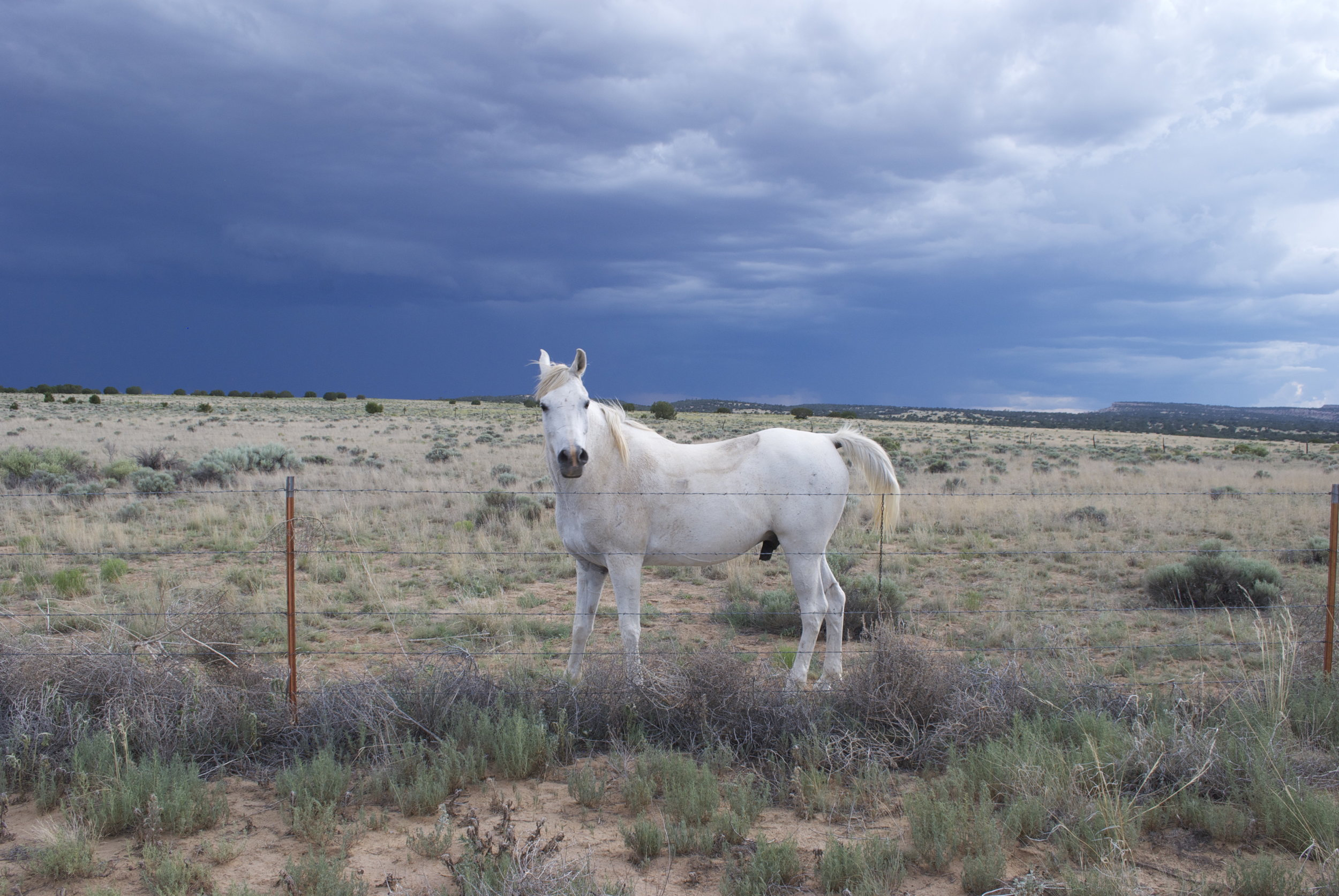
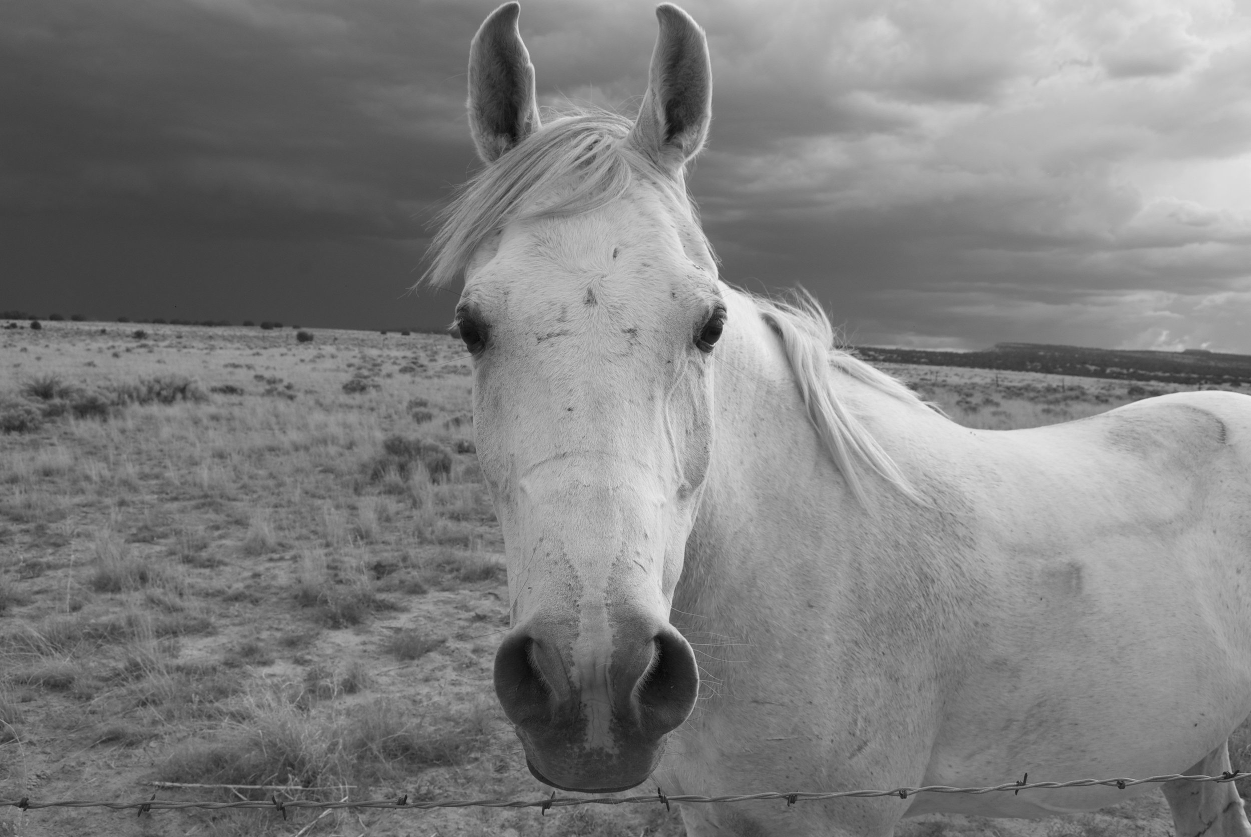
This is an old blog post from 2013. I kept it from my old site because this place was so beautiful and my brother took some great pistures.

Throughout this summer I have been working away for the two exhibitions I participated in June and July. Though I love the feeling of working like a madman for a show, I spent many days longing for the beauty and allure of the wilderness. For good reason too. It was summer. The perfect time to escape the city for a week away from the human being and its vast egocentric display of development. I had work to do however, so the mountains and I had to wait for the creative circle to run its course. After two successful shows, it was time to see the city of Albuquerque off and embark on the kind of adventure that does not include pavement, street lights, motor vehicles, and the most wretched of all… Super marts.

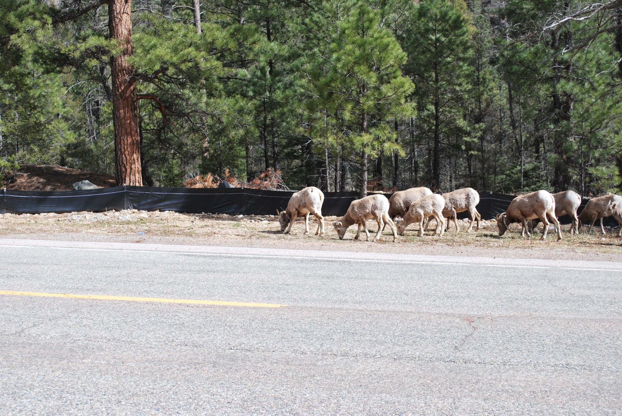
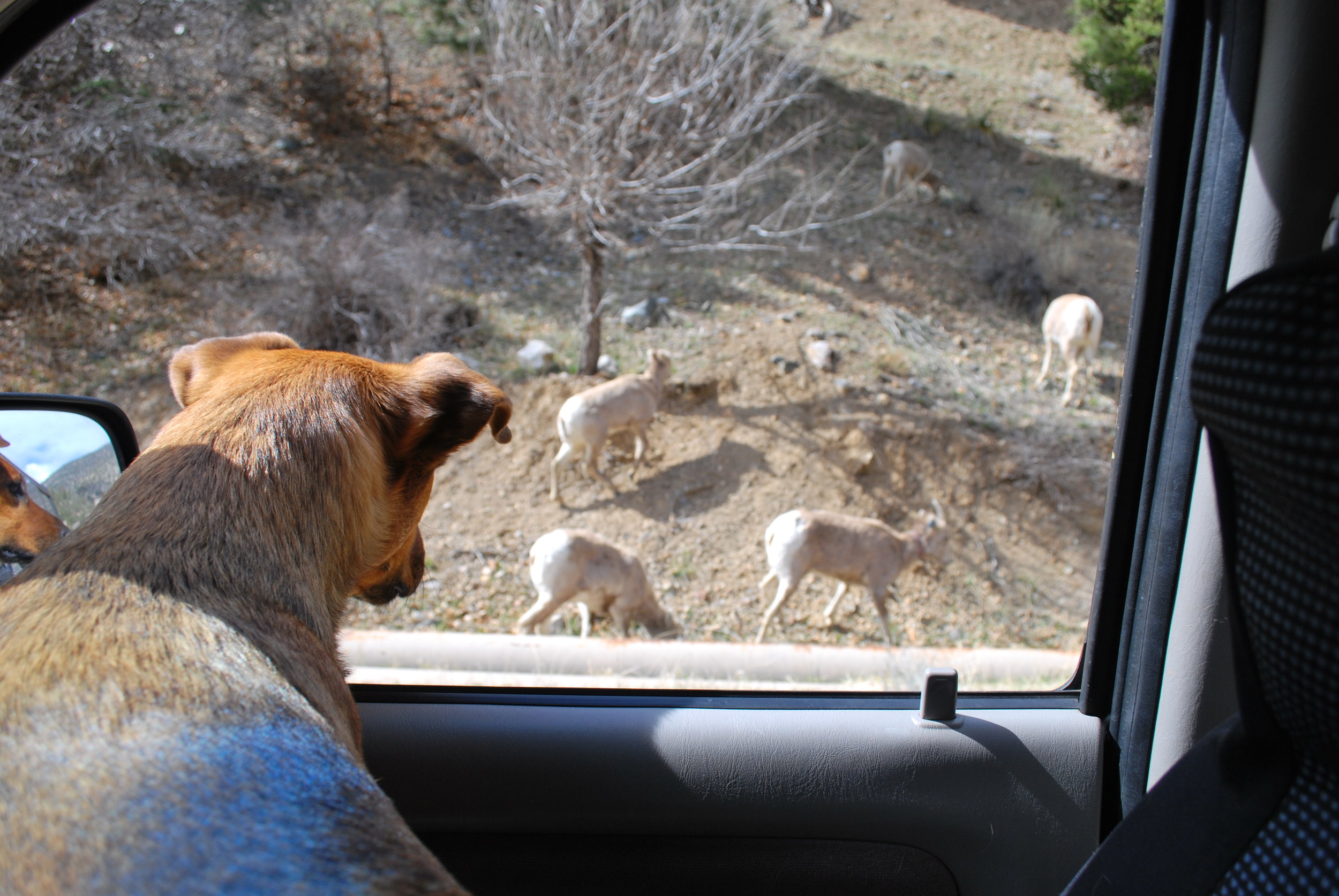
Since it was late summer, the cool and lush Eden of the Colorado Rockies overshadowed the allure of Utah’s many mysterious canyons. Our destination would be the Weminuche wilderness, named after the native people who inhabited this place. It is Colorado’s largest wilderness area nestled the middle of the San Juan mountains. Home to a few 14ers and numerous 13ers as well as a bountiful biological ecosystem that includes numerous deer, big horn sheep, black bears, and a wide variety large raptors.

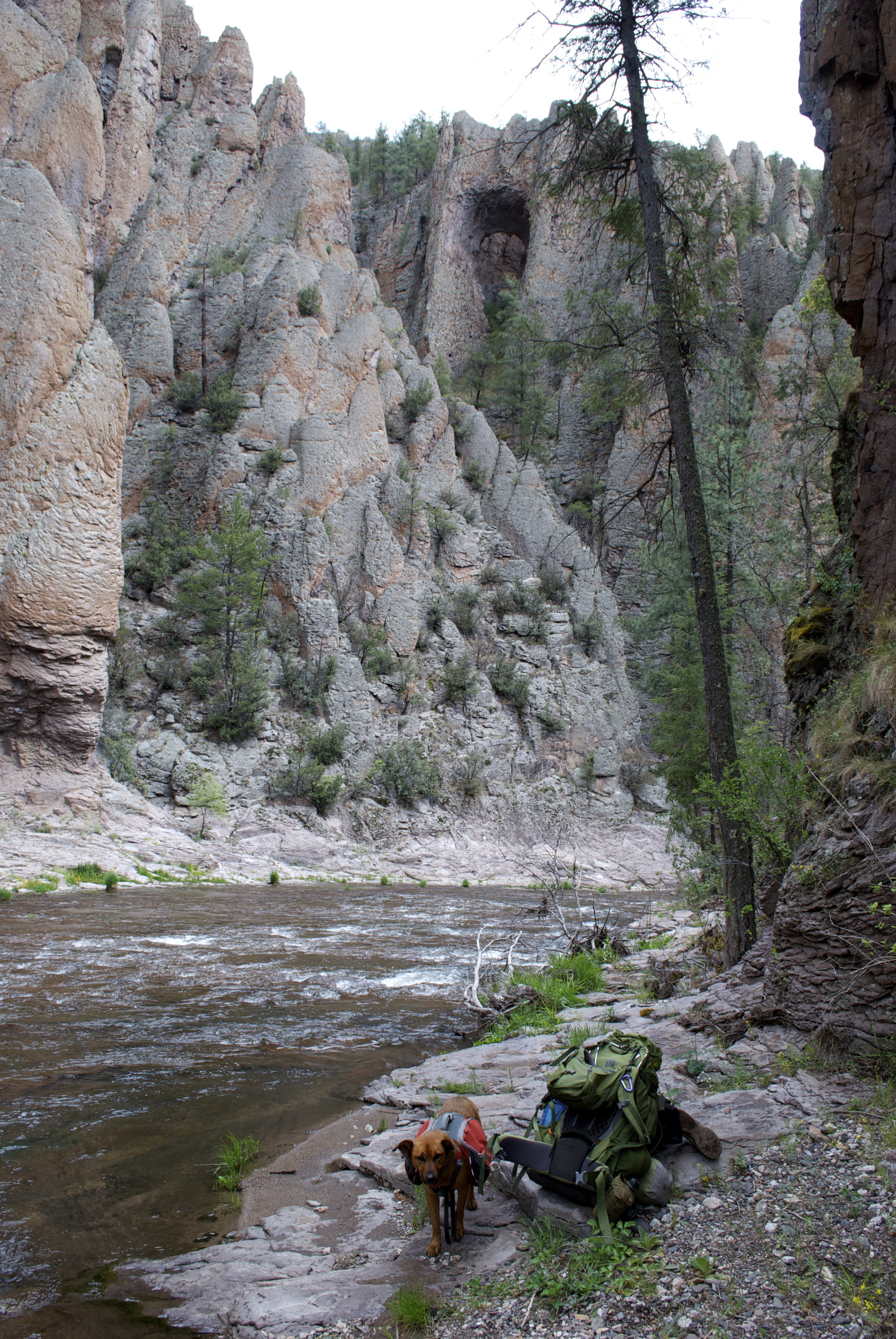
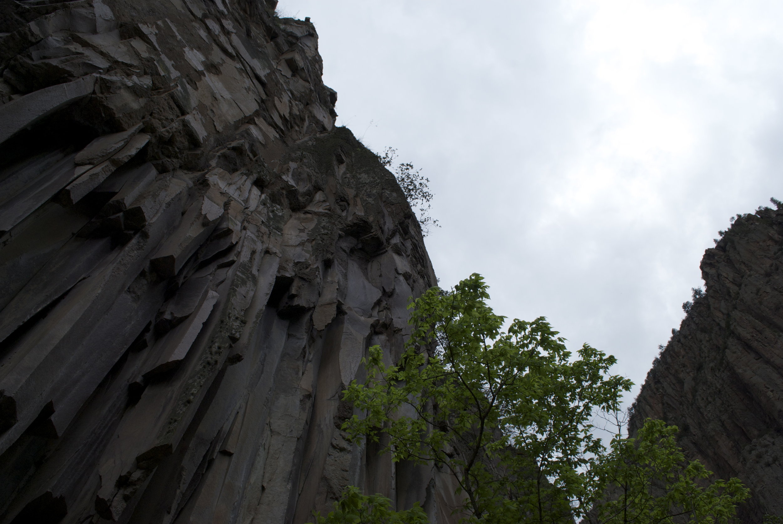
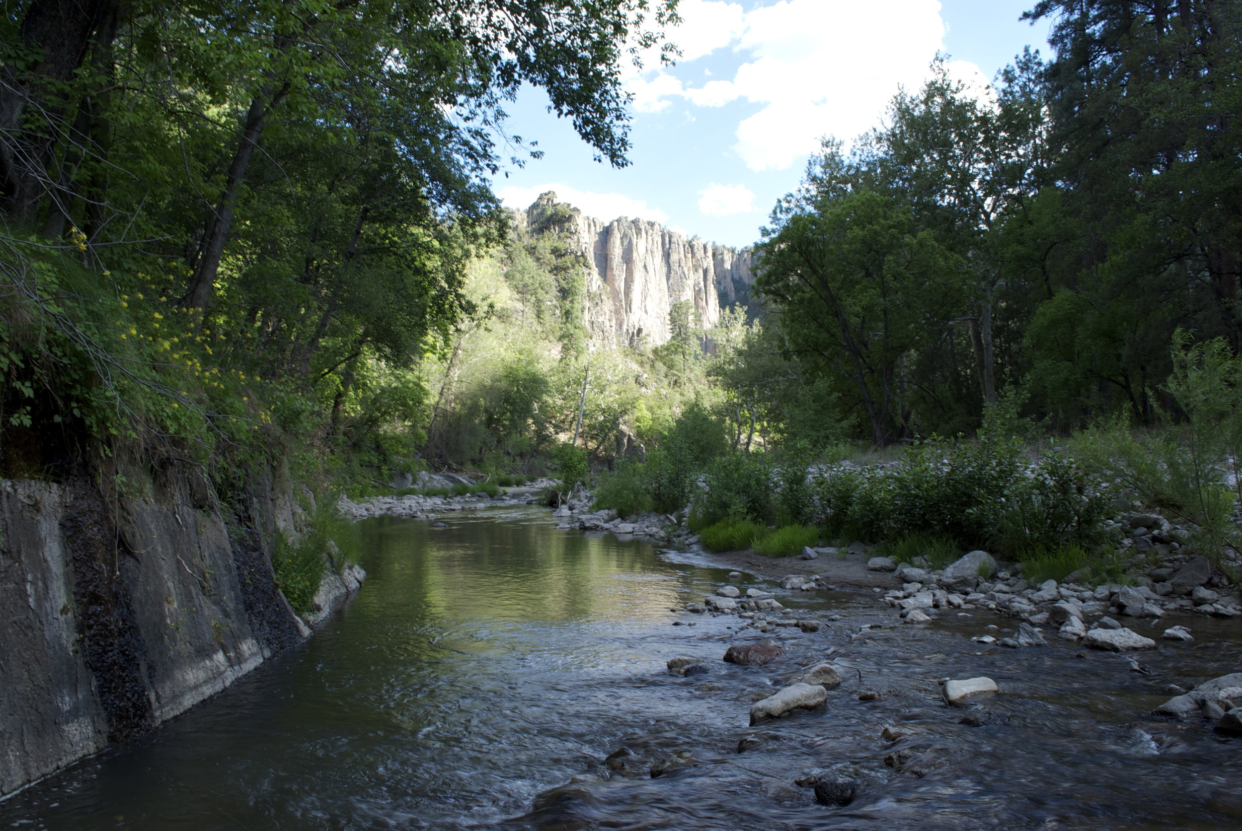
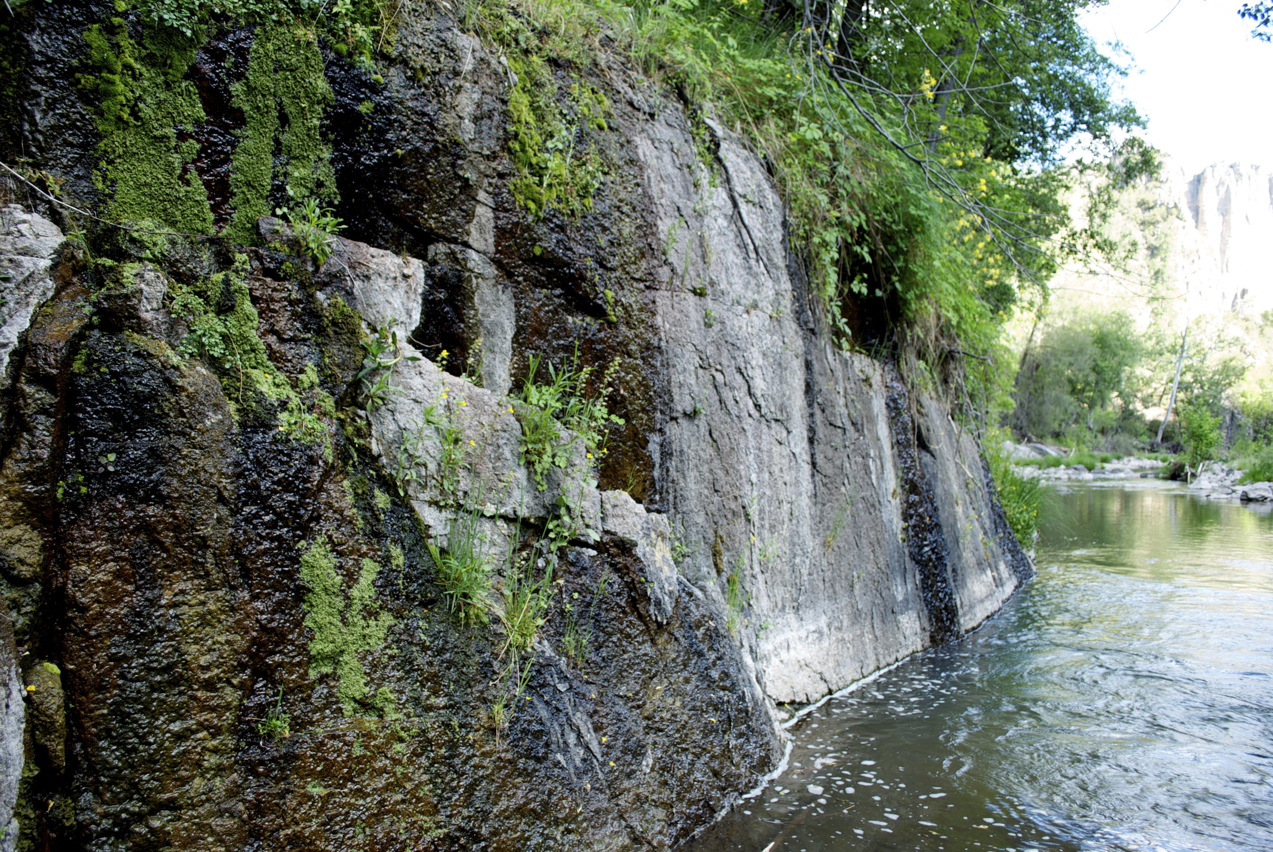
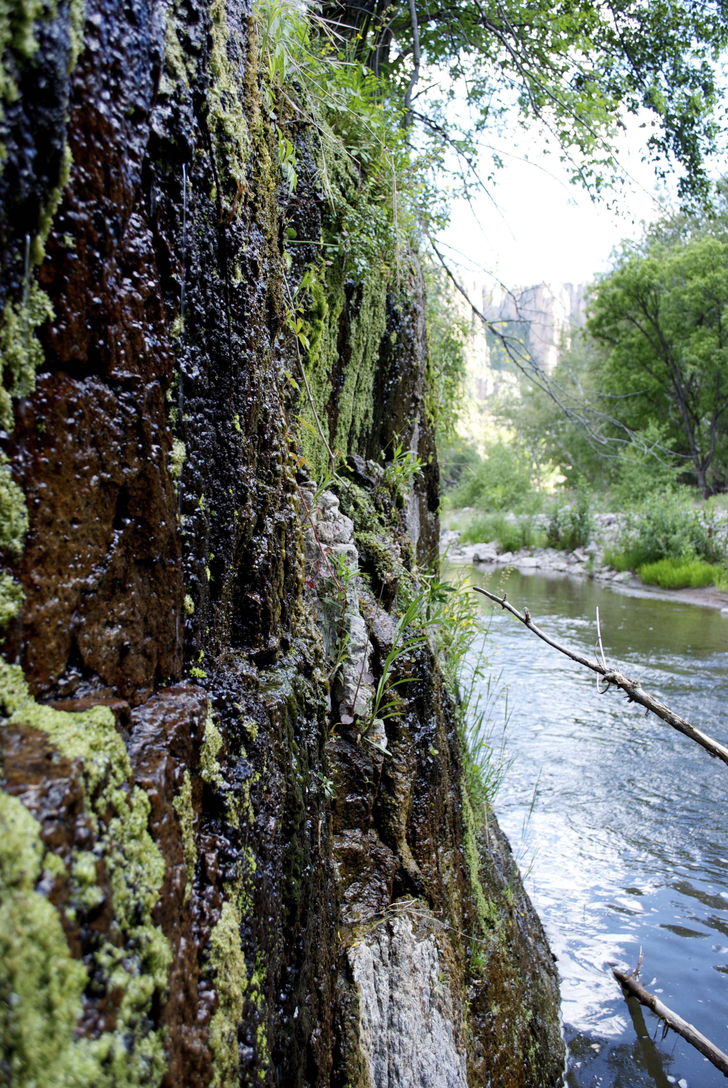
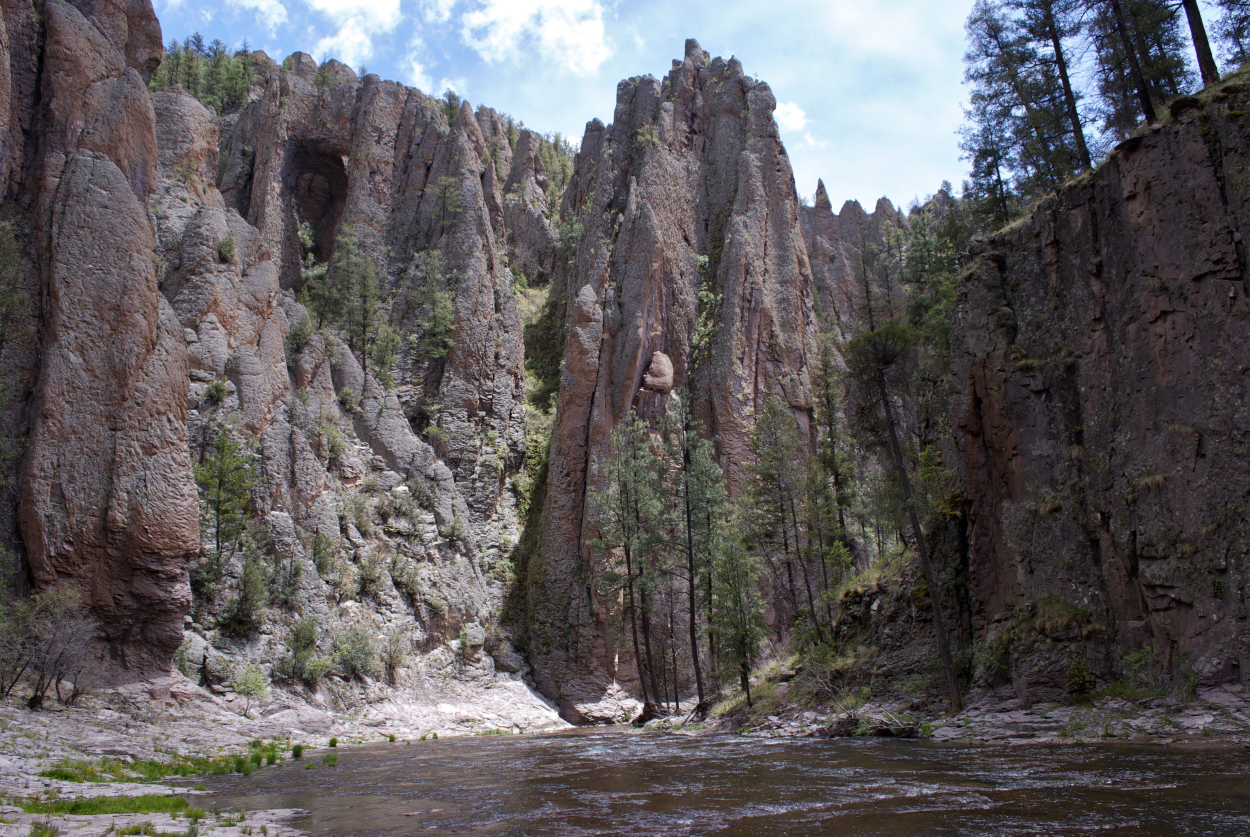
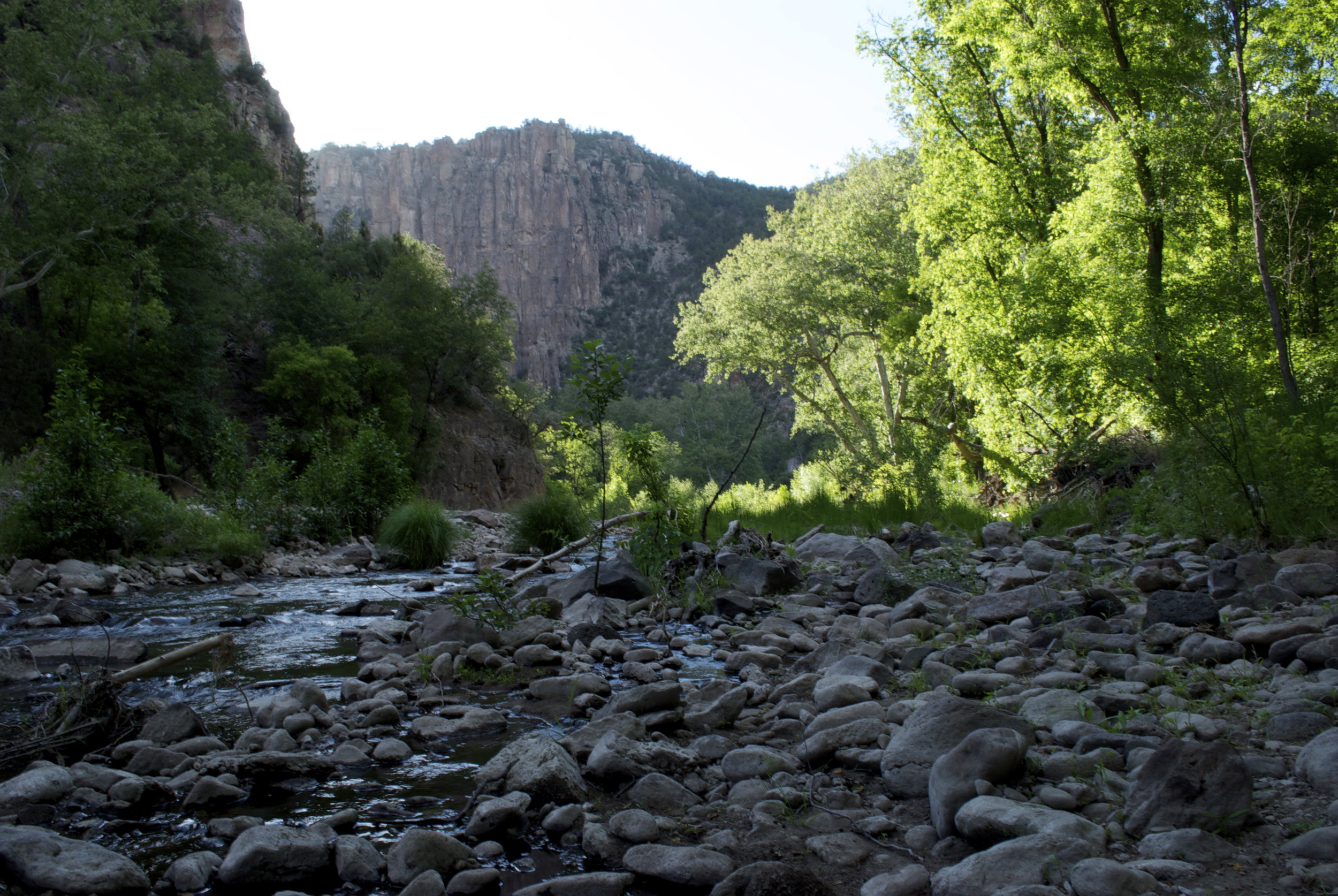
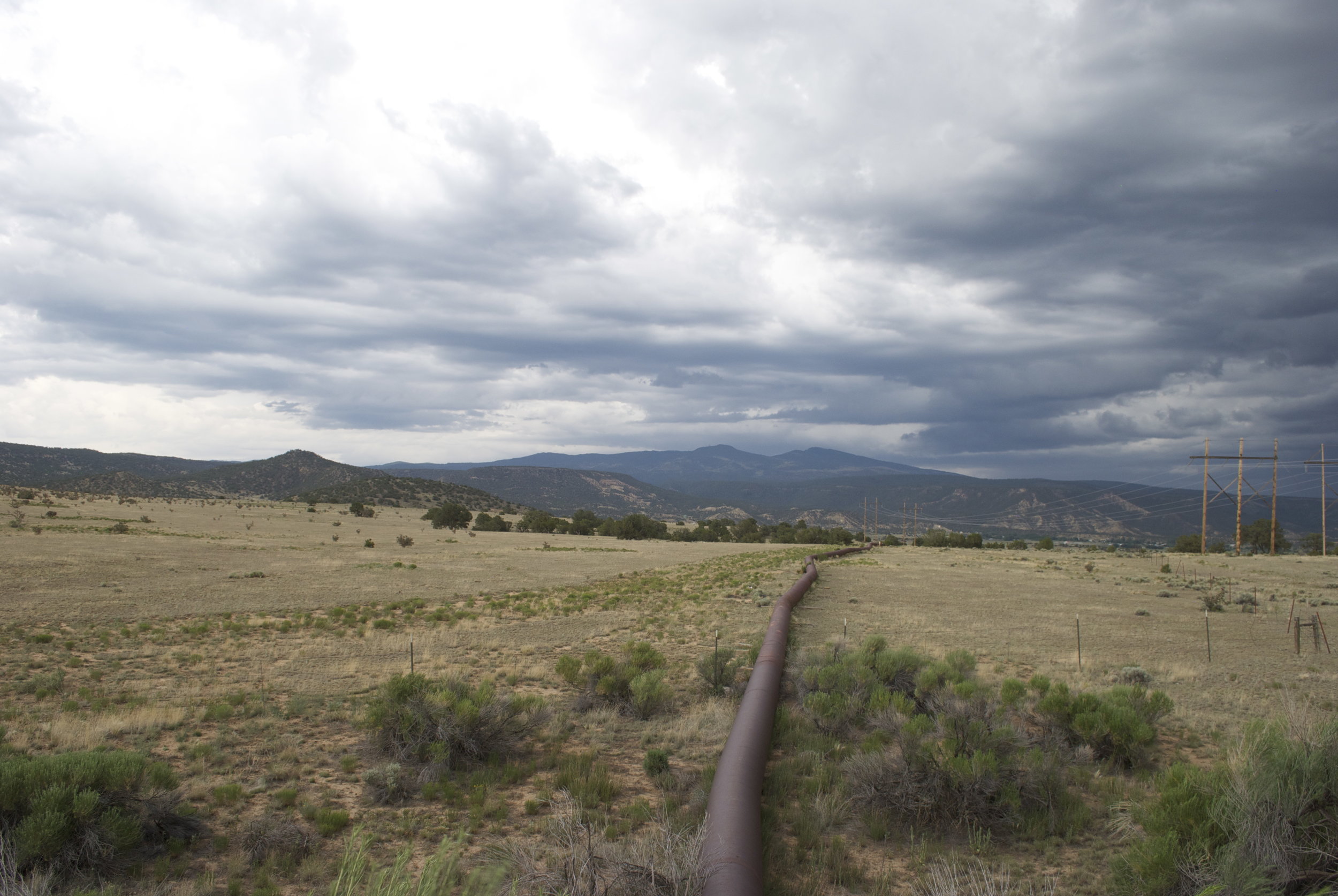
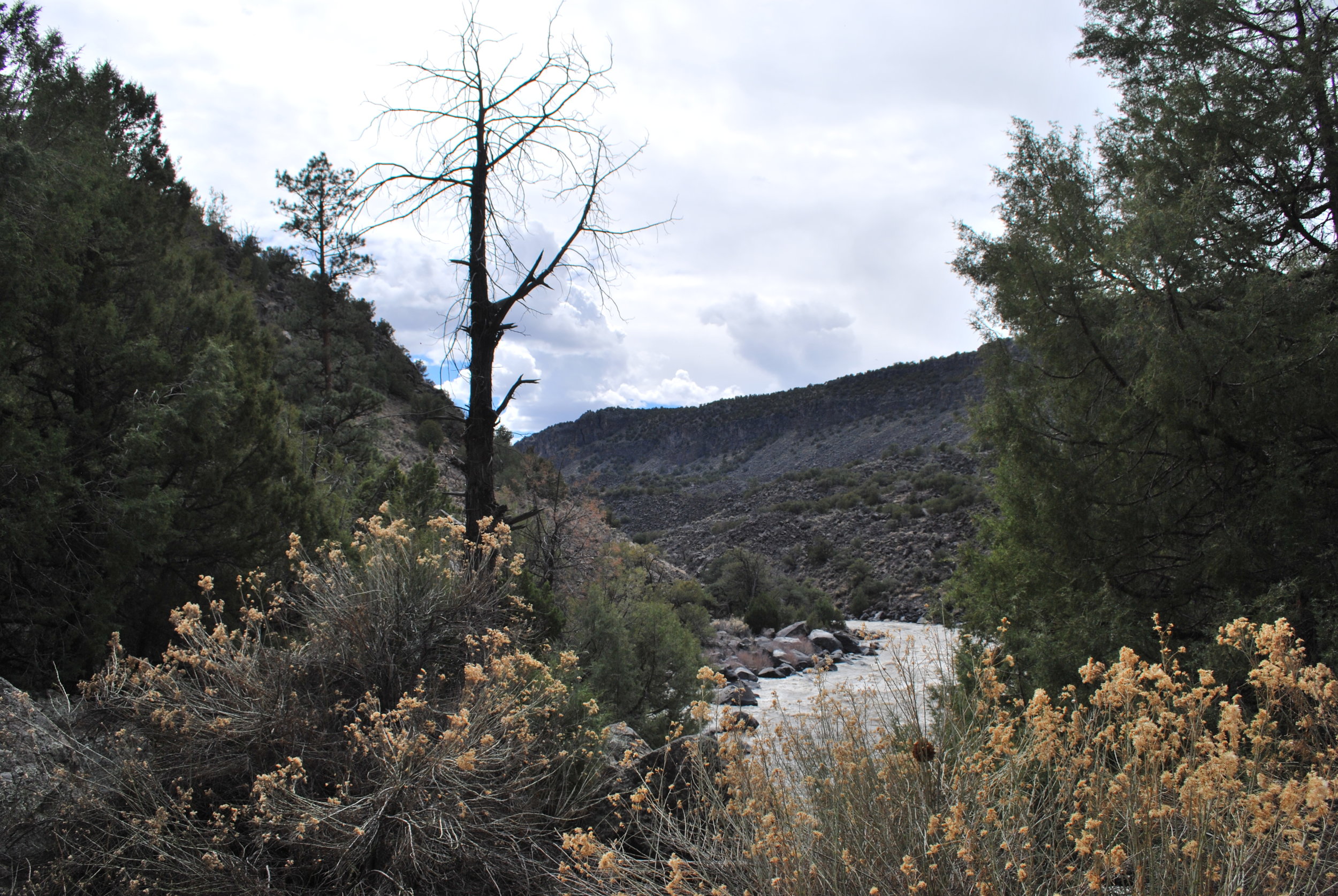
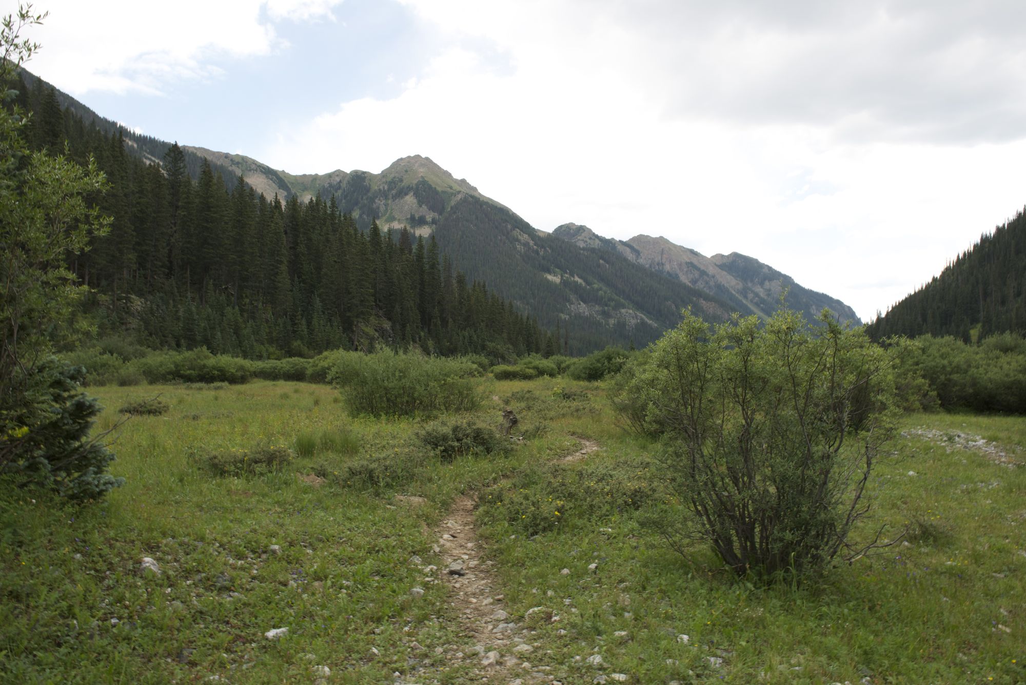
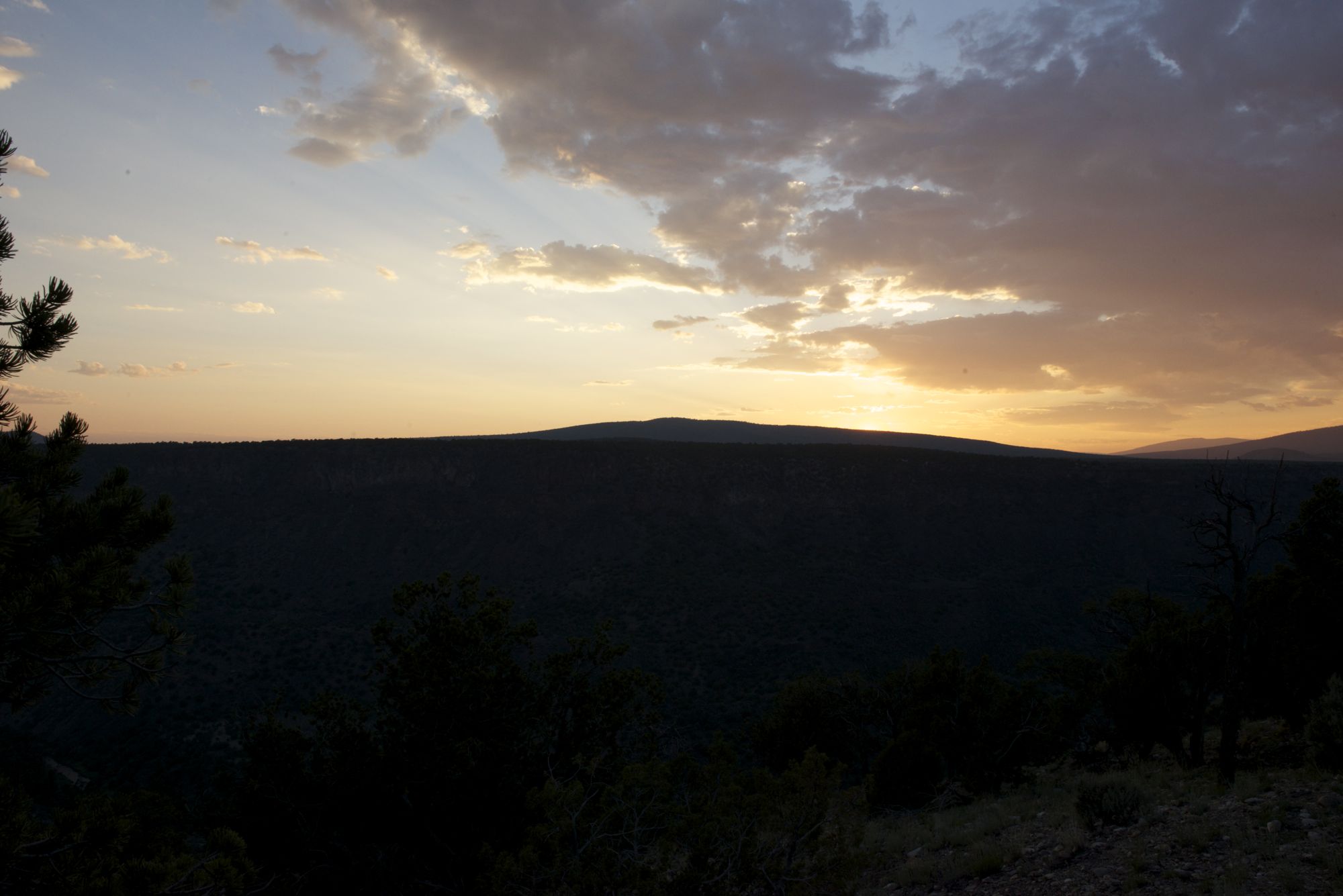
Day one we left Burque and headed northwest through Farmington, Aztec and eventually hit Durango. From there we went west to Vallecito Reservoir. We arrived at around 6 pm, cooked burritos for the next few days and put on our packs. We made it in about a mile past the official wilderness sign (3 miles in) and set up camp. Spending the evening suckin on smoke, beer, and pure water from the Los Pinos River. Dali went wild chasing ducks while I baptized my head in the mountain waters. Reborn once again, I began to investigate the brightly colored fungi, ferns, and the many plants of this forested alpine paradise. The landscape was a spectrum of forest green framed by dark grey browns of the volcanic rocks and the lighter granite peaks. Living as visitors in densely packed forests interspersed with meadows, and catching glimpses of Pine, aspen, and mixed conifers rising to alpine peaks nearly 14,000 feet in the air. A bit more smoke, some food, and a good night rest await. The journey really begins at the next awakening.

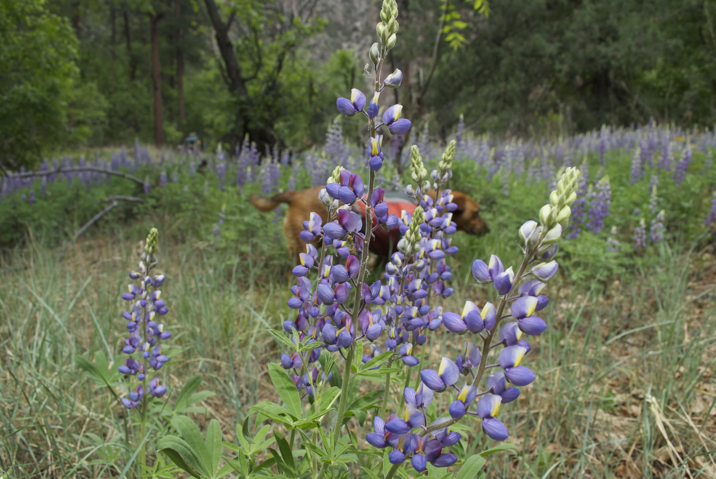
Over the next few days we hiked another 12 miles. Some of which was very intense uphill ground winding on endless switchbacks going straight up, mixed with sloped crossings of ridge after ridge. The beauty of the place however, far surpassed the strenuous climb up to the next juncture. Emerald Lake! Atop the last ridge crossing was yet another less steep uphill. At the top of the mountain was two very sizable pristine mountain lakes framed by another set of peaks towering into the air. The lakes, abundant with many species of freshwater trout, begin at the banks clear and reflect the red brown color of the rocks below. Once the water reaches a couple of feet deep it transitions into a bright emerald green that slowly fades into a deep blue green where the water is deepest. Little Emerald is about a half mile long in each direction and emerald lake is about two long, but only a half mile across. The abundance of the lake and the meadows that follow the pine river up to the next mountain peaks make it easy to spot wildlife of all types. Lots of deer, marmots, a few elk, eagles, hawks, and potentially some big horn sheep. In the valley and headwaters that feed the emerald lakes the land is lush. A perfect home for the wild at heart and in manifest.

This land is the kind of stories of old, paintings of the west, and naturalist writers. A testament to what the American west used to be, Pristine and untouched. Aside form the trail, there is very few signs of the human footprint. Solitude with abundance during day and dark skies with trillions of stars at night. It is truly amazing to look at the sky without light pollution, which hides at least 80 percent of the stars in larger towns and upwards of 90 percent in cities. It is truly amazing to me that the majority of the population has very little connection with these vast and wonderful celestial beings. Talk about an ego crisis. Looking at the sky, bright with thousands upon thousands of other suns and galaxies existing thousands of light years away, the layers of ego fall like cooked layers of an onion. A true map of the past. Here and now. Best of all, it is real! Its not on a tv screen, or a backdrop, or some digitally enhanced scene too mathematically stale to be a real place. It is the reality of life on earth. A peek into a past not so far away from now. A reason to rethink the current state of affairs in global and national politics. Ahhh…. The stars. My brothers of wisdom. Peal this modern day ego and send it down the pine river to the Los Pinos and eventually down the San Juan to the Colorado and out to the pacific ocean. That is if it can get through all the dams that have made the river nearly run dry as it approaches the delta in California.

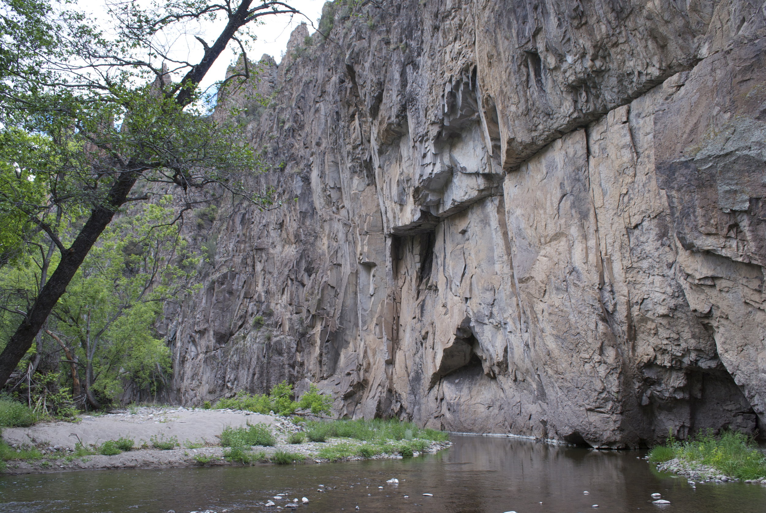
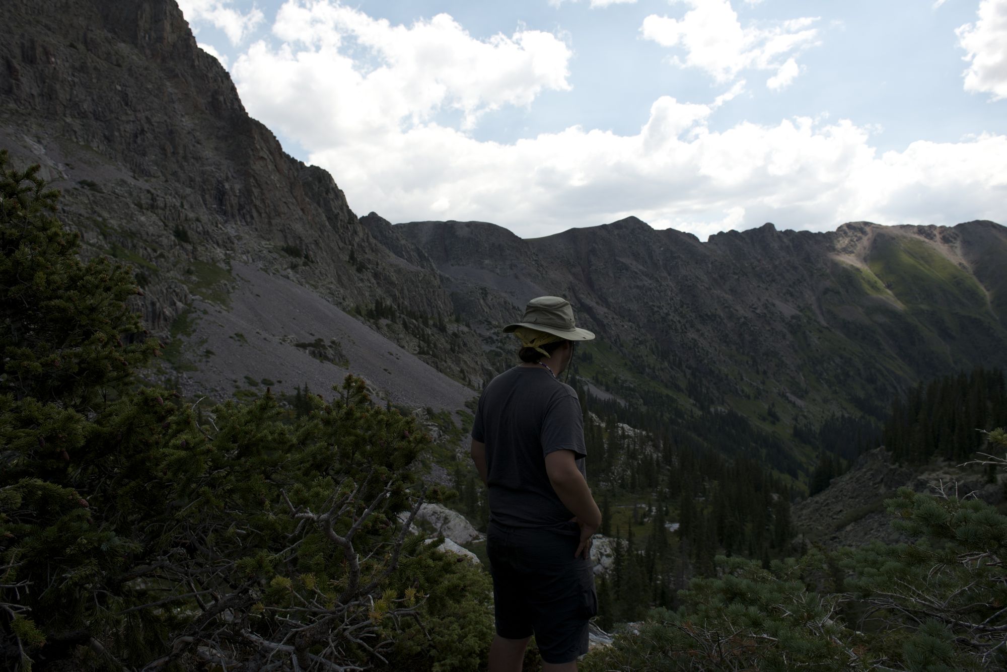
After reflections of a night with the stars it was up the pine river, crossing even steeper passes and sometimes having to rely on one arm to stabilize the ascend up past 12,500 feet. The forests become more interspersed and the alpine meadows begin to dominate the landscape. The rising peaks are the headwaters for this canyon and small, but beautiful waterfalls riddle the landscape. The birds seem to like it up here, especially eagles and hawks which most likely find the near by fishing and marmot hunting to be exceptional. After crossing high mountain streams and climbing another thousand feet through sometimes steep and rocky terrain, we find ourselves below another waterfall. The ridge seems to end above it. Weaving through another set of rocky switchbacks, my body longing for the promise of yet another high mountain lake, we ascend up the rock to meet the small valley. At the top of the rocks lies Moon Lake. A higher section of Eden characterized by the sparse and small twisty trunks of the Engelmann Spruce that extend at the most about 20 ft into the air (much smaller than the forests just 500 ft below).  The temperature is much cooler and one can see the trees gradually become smaller and sparser as they rise to the next ridge close above moon lake. Above that the trees lose their hold and the bare granite rocks rise out of the green vegetation of earths highest meadow. Framed almost perfectly in center between two smaller peaks is Mount Oso rising to 13,690 feet characterized by its stark likeness to a bear head. Im sure there are Osos that visit Mt. OSO.

Moon Lake is a much smaller lake that wraps around a shallow ridge which provides 360 degree spectacular views of the mountains just traversed and more sharp Rockies up the pass to the southwest. Here you can see how far the climb was. On the opposite view is Mt. Oso and you can see the saddle that extant over Half Moon Lake and over the pass to rock lake and eventually to the flint creek trail. This was our planned route, but our supply of food is low. We made a grand mistake of forgetting granola, crackers, and potatoes. We had plenty of protein with beans, nuts, cheese, and a few fresh veggies, but we had been running very low on the quick carbs that provide quick energy and full stomachs. Our bodies felt a little under nourished, and the sight of low amounts of food made us decide that two to three more nights would be risky. We decided to enjoy the pure splendor of Moon Lake for the rest of the evening and well into noon the next day. Watching the birds below the high ridge fly from tree to tree chasing marmots, and having coffee with groups of deer makes you wonder why we traded it all for the stale comfort of McDonalds and Wall mart.

At around noon we departed from the majestic alpine wonderland and headed back down the same steep slopes we climbed. After passing the first 7 miles with relative ease, we decided to do the rest. There seemed to be enough light. Soon however, the relentless pounding of rocks beneath our gracefully falling bodies straining against the natural process of gravity took its toll and all of us had passed our fill. The faster paced fading of light was another concern as we were still about 4 miles from the truck. Adrenaline and promise of nutrients and a cigarette somehow fueled us to keep going long after we had reached our point of near exhaustion. At a little after nine, after hiking a good hour and a half in the dusk and dark, we made it to the truck. The sudden quench of water later made us throw it up less than a half hour later. On an empty stomach we made our way to camping and replenished our bellies. All of this totally and completely worth it to spend a full 5 days away from all unnecessary annoyances and dramatic behavior created by the festering population of the contemporary human. Possibly the strangest and most fucked up animal on the planet. A renewed realization of what heavenly realities could exist and furthermore, for the sake of humanity and the earth itself, should exist.


top moon.jpg
trail.jpg
Trip Pics-27.jpg
wild sunset.jpg

Latest Posts

Featured
Dec 13, 2017
Oil Birds
Dec 13, 2017
Dec 13, 2017
Dec 10, 2017
The Gila Wilderness
Dec 10, 2017
Dec 10, 2017
Nov 30, 2017
Ambrosia Lake and Mt. Taylor
Nov 30, 2017
Nov 30, 2017
Nov 30, 2017
Questa Mine
Nov 30, 2017
Nov 30, 2017
Jun 3, 2017
Wemenuche
Jun 3, 2017
Jun 3, 2017

Copyright © 2010 Zane White Fine Arts. All Content on this page is owned and authored by Zane White. Any unlicensed reproduction of materials on this site, without written consent by Zane White, is strictly prohibited.

Powered by Squarespace